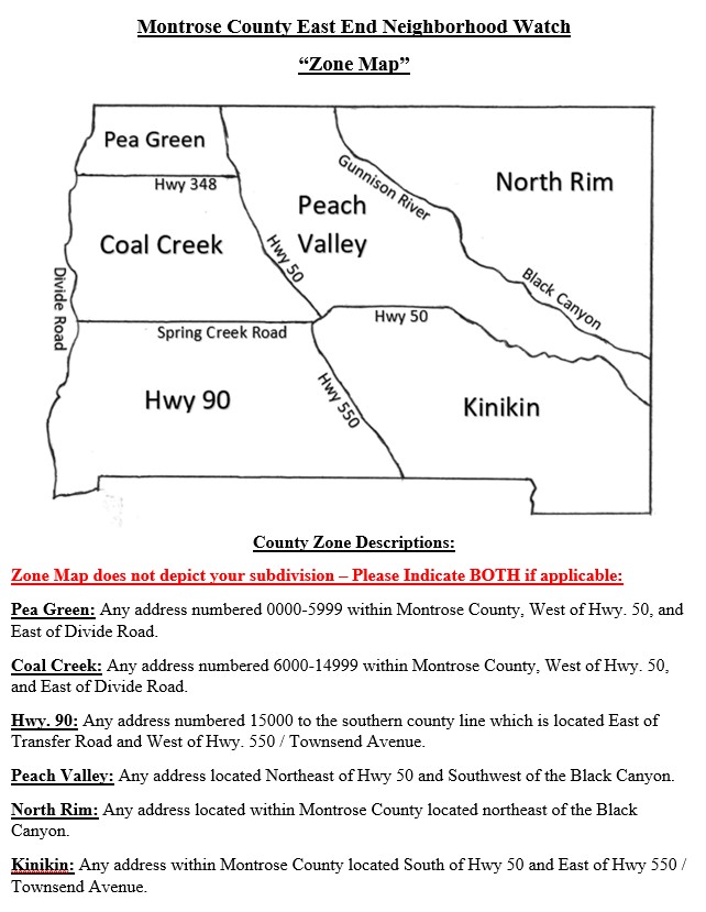
County Zone Descriptions
Zone Map does not depict your subdivision. Please indicate both if applicable.
Pea Green – any address numbered 0000-5999 within Montrose County, West of Highway 50 and East of Divide Road.
Coal Creek – any address numbered 60000-14999 within Montrose County, West of Highway 50 and East of Divide Road.
Highway 90 – any address numbered 15000 to the southern county line which is located East of Transfer Road and West of Highway 550/Townsend Avenue.
Peach Valley – any address located Northeast of Highway 50 and Southwest of the Black Canyon.
North Rim – any address located within Montrose County located northeast of the Black Canyon.
Kinikin – any address within Montrose County located South of Highway 50 and East of Highway 550/Townsend Avenue.

